Autodesk AutoCAD Civil 3D 2025
Autodesk AutoCAD Civil 3D 2025 is a comprehensive design and documentation software solution developed by Autodesk, specifically tailored for civil engineering and infrastructure projects.
Autodesk AutoCAD Civil 3D 2025 Description
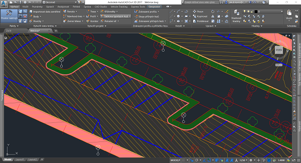
Civil 3D provides a robust platform for designing, drafting, and managing all aspects of civil engineering projects, including transportation, land development, water, and sewer projects. By integrating powerful tools for surveying, terrain modeling, alignment design, and more, Civil 3D enables engineers and designers to efficiently plan and execute large-scale infrastructure projects.
Autodesk AutoCAD Civil 3D 2025 is a comprehensive solution for civil engineering and infrastructure projects, offering a wide range of tools for design, analysis, and documentation. Its integration with BIM workflows, advanced modeling capabilities, and support for collaboration makes it an essential tool for civil engineers and designers.
Whether working on transportation networks, land development, or water resources, Civil 3D provides the tools needed to efficiently plan, design, and manage complex infrastructure projects.
Features Of Autodesk AutoCAD Civil 3D 2025
- Integrated Design and Documentation:
- Dynamic Modeling: Civil 3D uses a dynamic engineering model that allows changes made in one part of the design to automatically update across the entire project. This reduces errors and ensures consistency between design and documentation.
- Plan Production Tools: The software includes tools for generating construction documentation directly from the 3D model, including plans, profiles, sections, and detail sheets.
- Terrain Modeling and Grading:
- Surface Creation and Analysis: Civil 3D enables users to create accurate terrain models (surfaces) from survey data, point clouds, and other sources. The software provides tools for analyzing these surfaces, including contour generation, slope analysis, and volume calculations.
- Grading Design: Civil 3D includes advanced grading tools that allow users to design complex grading projects, such as building pads, roads, and drainage systems. The software supports automatic updates of grading elements when the underlying terrain changes.
- Corridor Modeling and Roadway Design:
- Alignment and Profile Design: The software includes tools for designing road alignments and profiles, which are essential for road and highway projects. These tools support the creation of complex road networks with varying cross-sections, superelevations, and other design features.
- Corridor Modeling: Civil 3D’s corridor modeling tools allow users to design roads, highways, and other linear infrastructure. Corridors can be dynamically linked to alignments, profiles, and assemblies, ensuring that design changes are reflected throughout the model.
- Pipes and Utility Networks:
- Pipe Network Design: Civil 3D provides tools for designing stormwater, sanitary sewer, and other utility networks. Users can create pipe networks using predefined parts catalogs, and the software automatically generates profiles and sections for these networks.
- Pressure Networks: The software also supports the design of pressure pipe networks, including water distribution systems. Civil 3D allows for the analysis and design of pressure pipes, fittings, and appurtenances within the context of the overall project.
Password: 123


