Global Mapper 26.0
Global Mapper 26.0, released by Blue Marble Geographics in September 2024, introduces several enhancements to its GIS capabilities, focusing on user experience, data processing, and advanced analysis tools.
Global Mapper 26.0 Description
These updates in Global Mapper 26 aim to streamline geospatial data processing, enhance analytical capabilities, and improve the overall user experience for GIS professionals. Download Global Mapper software is a software that uses Geographic Information Systems (GIS), which is a computer system for managing and analyzing spatial information and can collect, store, analyze, and display geographic (spatial) information.
Geographic (GIS) data is displayed based on their location. GIS technology provides information for preparing maps by collecting and integrating information from conventional databases, through visualization and the use of geographic analysis. This information is used to make events clearer, predict outcomes, and prepare maps.
Features Of Global Mapper 26.0
- Global Command Search: A new tool that allows users to quickly access any function within Global Mapper by typing keywords, streamlining workflow efficiency.
- Flattened Site Plan Grid Creation: Enables the generation of a flattened site plan where all edited terrain is contained within selected areas, facilitating site planning and terrain editing.
- Perpendicular Profile Line Editing: Introduces the ability to edit line features directly within Perpendicular Profile views, enhancing precision in profile editing tasks.
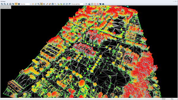
- 3D Viewer Walk Mode Integration: Adds an option to display the 3D Viewer Walk Mode position within the 2D map view, improving spatial awareness during navigation.
- Enhanced LAS/LAZ File Support: Supports reading and displaying ‘extra bytes’ fields from LAS/LAZ files, with the ability to save these to GMP files, enhancing point cloud data management.
- Raster and Terrain Layer Copy-Paste: Enables copying and pasting of raster image and terrain layers, simplifying data manipulation and project setup.
- Cesium Export Support: Adds export capabilities for Cesium terrain and 3D tiles formats, facilitating the sharing of 3D geospatial data in web applications.
- New Online Data Sources: Introduces a high-resolution Global Marine Basemap from TCarta and adds a search filter to navigate the list of online sources more efficiently.
Password for file: “123“


