CADValley infraWizard 24
CADValley infraWizard 24 is a specialized software tool designed to streamline the creation and management of infrastructure projects within the civil engineering and construction industries.
CADValley infraWizard 24 Description
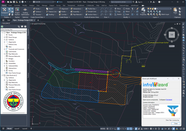
infraWizard provides a comprehensive suite of tools for designing, analyzing, and visualizing infrastructure elements such as roads, highways, drainage systems, and utilities. CADValley infraWizard is a robust and versatile tool designed to meet the needs of professionals in the civil engineering and construction industries. Its comprehensive suite of features, user-friendly interface, and integration capabilities make it an essential tool for efficient design, analysis, and management of infrastructure projects.
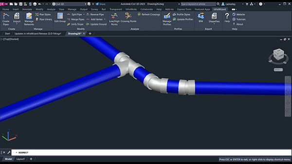
You can also add geometric information such as size, inverted surfaces, length, and coordinates along with pipes and nodes. By saving and exporting BIM network models as AutoCAD 3D elements, you can continue editing them in AutoCAD or quickly and easily integrate your BIM model with other project components in other BIM modeling programs, such as Autodesk Navisworks.
Features For CADValley infraWizard 24
1. Comprehensive Design Tools
- Road and Highway Design: This program provides advanced tools for designing roads and highways, including alignment, profile, and cross-section creation.
- Utility Network Design: Facilitates the design of utility networks, such as water supply, sewage, and stormwater drainage systems, with precise modeling capabilities.
- Intersection Design: Includes features for designing complex intersections, ensuring smooth traffic flow and safety.
2. Integration with CAD Platforms
- AutoCAD Integration: Fully integrates with AutoCAD, allowing users to leverage familiar CAD tools and workflows while utilizing infraWizard’s specialized infrastructure design capabilities.
- BIM Compatibility: Supports Building Information Modeling (BIM) workflows, ensuring seamless data exchange and collaboration across different disciplines and project stages.
3. Advanced Analysis and Simulation
- Hydraulic Analysis: Offers hydraulic analysis tools to simulate and evaluate the performance of drainage and sewage systems under various conditions.
- Traffic Simulation: Includes traffic simulation capabilities to analyze and optimize traffic flow, ensuring efficient and safe transportation infrastructure designs.
- Earthwork Calculation: Provides tools for calculating earthwork volumes, helping plan and optimize excavation and fill activities.
4. 3D Visualization and Rendering
- 3D Modeling: Allows the creation of detailed 3D models of infrastructure projects, providing a clear and realistic visualization of the design.
- Rendering: Supports high-quality rendering to produce photorealistic images and animations, enhancing presentations and stakeholder communications.
- Virtual Reality (VR) Support: This includes VR support for immersive project visualization and walkthroughs, which improves understanding and collaboration.
Password for file: “123“


